


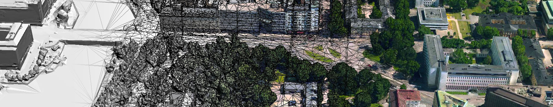
With ContextCapture Center, you can quickly produce even the largest and most challenging 3D models of existing conditions for infrastructure projects of all types, including scales as large as entire cities, derived from any digital photographs. It will provide support for the most sophisticated aerial camera systems, including UAVs acquisition systems and laser scanners. Without the need for expensive and specialized equipment, you can quickly create and use these highly detailed 3D reality meshes to provide precise real-world context for design, construction, and operations decisions for use throughout the lifecycles of projects.
Develop precise reality meshes, affordably, with less investment of time and resources in specialized acquisition devices and associated training. You can easily produce 3D engineering-ready reality meshes using photos taken with an ordinary camera or combine the photos with point clouds from laser scanners resulting in fine details, sharp edges, and geometric accuracy.
You will have the confidence to reliably deliver any size or resolution model in less time without risks of software limitations. You can create highly detailed models of virtually any size and/or precision, up to city scale, much faster than previously possible thanks to support for parallel processing using multiple computers.
You can access and share these rich reality meshes of existing conditions for use in any engineering or GIS workflow. You can easily and consistently share information, consumable and accessible, on desktop and mobile devices, in many formats, including native use within MicroStation. You can even leverage a software development kit to create custom solutions to fit your unique organizational needs.
Extend your capabilities to extract value from reality modeling data with ContextCapture Editor, a 3D CAD module for editing and analyzing reality data, included with ContextCapture Center. ContextCapture Editor enables fast and easy manipulation of meshes of any scale as well as the generation of cross sections, extraction of ground and breaklines, and production of orthophotos, 3D PDFs, and iModels. You can integrate your meshes with GIS and engineering data to enable the intuitive search, navigation, visualization, and animation of that information within the visual context of the mesh to quickly and efficiently support the design process.
